![]()
Lake Champlain Basin Atlas
![]()
Lake Champlain Basin Atlas
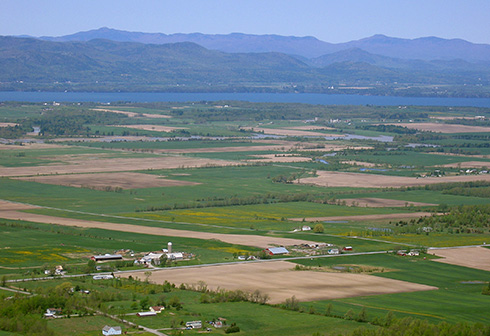
The Champlain Valley is bounded by the Adirondack and Green Mountains.
The topography visible in the Lake Champlain Basin today is the result of millions of years of mountain building, erosion, and ice, a rugged landscape shaped by glaciers that passed through the valley and scoured the surface of the mountains. Most of the Basin can be divided into five distinct physiographic regions: the Champlain Lowlands or Champlain Valley, the Green Mountains, the Adirondacks, the Taconic Mountains, and the Valley of Vermont. The Vermont Piedmont and Hudson Valley regions make up small portions of the Basin.
The Green Mountains, Taconic Mountains and Adirondack Mountains contain the highest peaks surrounding Lake Champlain and form the headwaters of many rivers that flow to Lake Champlain. Most of the rain and snow that falls on this watershed eventually ends up in the Lake. The Valley of Vermont is a small section of rich agricultural lands between the Green Mountains and the Taconic Mountains that also supplies water to Lake Champlain.
The Landforms of the Basin map portrays the elevations, or relief, of the Basin by using a combination of color tones and shading. Low elevations, such as those in the Champlain Valley, are represented by deep greens. High elevations, found in the Adirondacks and Green Mountains, are represented by brown.
The Basin’s landforms have contributed to shaping patterns of settlement and land use since the first people arrived in the region, some 10,000 years ago. Most early Native American and colonial settlements were located by water, which was essential for navigation through the thickly forested mountains. Notice how many of the towns on the map are located along Lake Champlain and/or major rivers.
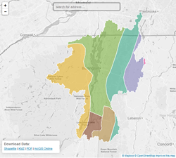
Educators and students: Draw your own land map! Visit the Blank Maps page of the Students and Educators section for an “empty” Lake Champlain Basin map.
Humans have inhabited the Lake Champlain Basin for millennia, and the full story began millions of years before the earliest humans walked the Earth. Go back 1.3 billion years on the Lake Champlain Basin timeline.
Learn More→
The CVNHP’s Guide to the Geology of the Champlain Valley documents the many sites that showcase the geologic history of the region.
Find out more →
© 2026 Lake Champlain Basin Program
LCBP is a program partner of
![]()