![]()
Lake Champlain Basin Atlas
![]()
Lake Champlain Basin Atlas
Point source pollution consists of waste products discharged from a specific point, such as a wastewater treatment facility or an industrial facility, such as a paper plant. Pollutants from these sources can usually be traced to a pipe or specific “point” of origin.
New York, Vermont, and Québec have invested significant resources to reduce the amount of phosphorus discharged by point sources in the Basin. Point sources now account for about 5% of the total amount of phosphorus entering Lake Champlain. The primary point sources of phosphorus in the Basin are 98 wastewater treatment plants: 59 in Vermont, 30 in New York, and 9 in Québec. Several industries and state facilities (such as fish hatcheries) also discharge phosphorus to Lake Champlain or its tributaries.
Upgrading phosphorus removal techniques at wastewater treatment plants has been a priority in the Lake Champlain Basin. In Vermont, meeting new EPA standards for phosphorus will require additional operational and capital improvement costs.
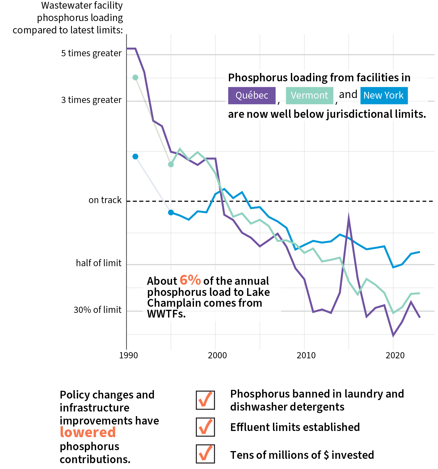
Annual phosphorus load from wastewater treatment facilities by jurisdiction.
Phosphorus loads from wastewater treatment facilities have declined dramatically in the last 25 years. In addition to improvements made to facilities, regulations banning phosphorus in detergents have greatly reduced the amount of phosphorus entering treatment facilities to begin with.
Unlike point sources, nonpoint sources (NPS) of phosphorus are areas where pollutants are washed off the land directly into water bodies by precipitation. The surface area of the Lake’s watershed is 18 times greater than the surface area of the lake itself, a much larger ration than most lakes. This means that activities occurring on the land have a direct and significant influence on the quantity and quality of the runoff. Nonpoint sources contribute about 95% of the total phosphorus load to Lake Champlain. A 2015 report prepared for the EPA estimated the percentage of phosphorus loading to the Lake from several categories of land use and from wastewater treatment facilities.
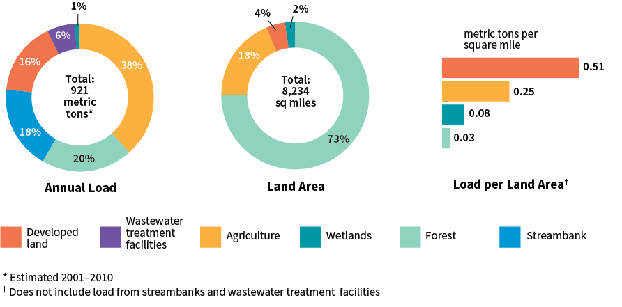
Annual phosphorus loading to Lake Champlain by land cover.
Impervious surfaces such as roofs and parking lots prevent precipitation from soaking into the ground.
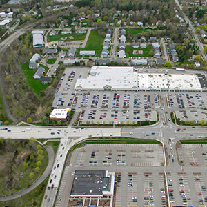
Urbanization has many negative impacts, including pollution from urban activities, increases in stormwater runoff, and physical changes to river systems and other natural filters such as wetlands. Development increases the amount of impervious area (such as roof tops and pavement) in a watershed, which interferes with the natural filtering ability of soils. The quantity of runoff also increases because soils can no longer absorb and store rain and snowmelt. Suburban and rural residential areas, commercial developments, industries, and roads all contribute phosphorus. Activities such as washing cars on roads and driveways, not cleaning up pet waste, and over-fertilizing lawns and gardens, can all contribute to nonpoint source phosphorus.
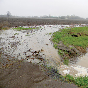 Agricultural activities are a major nonpoint source of phosphorus in the Basin and may also contribute significant quantities of sediment and toxic substances, such as pesticides. Major sources of agricultural phosphorus are manure and commercial fertilizer runoff from fields, soil erosion, runoff from livestock concentration areas, milkhouse effluent, runoff from stacked manure, livestock access to streams and ponds, and streambank erosion from livestock.
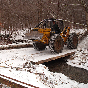 Forests cover about two thirds (66%) of the Basin’s surface area but contribute only 21% of the average annual nonpoint phosphorus load to Lake Champlain. Since approximately only one percent of the Basin’s commercial forests lands are harvested each year, forestry activities represent a very small percentage of the total pollutant load. However careful management practices are still critical. Tree harvesting and road construction can have significant local water quality impacts, such as stream sedimentation that can damage habitat for fish and other aquatic species.
The Vermont Agency of Natural Resource’s Clean Water Roadmap displays data about nonpoint source phosphorus loading to Lake Champlain from a variety of land cover types. This interactive online mapping tool provides information about the amount of phosphorus that runs off the landscape and the rate at which it is delivered to the Lake at several geographic scales.

© 2026 Lake Champlain Basin Program
LCBP is a program partner of
![]()